Cold front brings autumn temperatures and rain to Spain this weekend
As the summer heat begins to wane, a significant shift in weather patterns is on the horizon for Spain. The arrival of autumn is imminent, and with it comes a noteworthy change in temperatures and atmospheric conditions. This weekend, the Spanish Meteorological Agency (AEMET) has predicted a dramatic cooling trend that will mark the transition from summer to autumn, driven by a polar jet stream that will influence the weather across the peninsula.
While many may welcome the cooler days ahead, it’s crucial to remember that this shift does not negate the alarming trends associated with climate change. Despite the current temperatures still being above average, the recent summer has been one of the hottest recorded, with several heatwaves pushing temperatures significantly higher than normal. As the AEMET's spokesperson, Rubén del Campo, states, we can expect temperatures to drop substantially, signaling a stark contrast to the summer heat.
Forecast of cold, rain, and hail: AEMET's initial predictions
Beginning Saturday, AEMET has indicated that a substantial drop in temperatures will commence, particularly affecting the northern regions of Spain. For instance, cities like Bilbao, Vitoria, and Pamplona are projected to experience maximum temperatures that could be more than 15 ºC lower than those recorded on Friday.
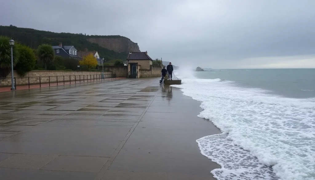
Moreover, the agency has warned of increasing atmospheric instability, which will lead to thunderstorms and heavy showers starting Friday and continuing through the weekend and into Monday. These storms, particularly in northern and eastern areas of the peninsula, may even produce hail.
- Temperature drops of 5-10 ºC are expected.
- Thunderstorms are likely in northern and eastern regions.
- Local hail is possible with intense showers.
Understanding the causes: What is the polar jet stream?
The polar jet stream is a fast-flowing air current high in the atmosphere, which can sometimes detach and create a trough that influences weather patterns below. The current shift in weather is attributed to such a trough, which is expected to move from west to east across Spain starting Saturday. A trough occurs when warm, moist air rises in a long, low-pressure area situated between two high-pressure zones, leading to the formation of vertical clouds associated with precipitation.
This interaction between air masses results in an increase in cloud formation and precipitation, which is precisely what we will witness as the polar jet stream influences our weather. Understanding this phenomenon is vital for grasping the changes we are experiencing.
The uneven arrival of autumn across Spain
The arrival of autumn will not be uniform across Spain. Although clouds related to the polar jet stream will begin to appear Friday, warmer temperatures will persist in many areas. For example, parts of the northern coast may still see temperatures exceeding 34 ºC, while southern regions could experience even higher temperatures, ranging from 36 to 38 ºC.
As the weekend progresses, thunderstorms are likely to develop in various parts of northern Spain, particularly in mountainous areas. As the trough advances, temperatures will begin to decline throughout the peninsula, although some Mediterranean areas may continue to experience warmer weather.
By Monday, most cities across the peninsula are expected to reflect typical autumn temperatures, with only a few southern cities like Sevilla, Córdoba, and Málaga possibly exceeding 30 ºC.
This won't be a drastic drop in temperatures
While significant changes are coming, predicting the exact weather beyond Monday remains challenging due to the current atmospheric instability. Presently, two potential scenarios are emerging based on the data:
- The first scenario involves a continuation of autumn-like conditions with increasing rainfall in southern and eastern regions.
- The second, more probable scenario suggests a resurgence in temperatures as the week progresses.
As Rubén del Campo notes, we must be patient and observe how these scenarios unfold. Regardless, the excessively warm temperatures that have dominated the summer months appear to be on the verge of decline.
Weather outlook for the Canary Islands
This Friday, the Canary Islands will experience a hot day, similar to many regions across Spain, with temperatures potentially surpassing 37 ºC and intense calima (dust winds). However, starting Saturday, a cooling trend will begin, with temperatures expected to remain above 34 ºC, albeit less oppressive than earlier in the week. By Sunday and Monday, temperatures will become more comfortable, resembling typical Canary weather as the calima dissipates.
Some light showers may occur, particularly in the mountainous regions, although significant rainfall is not anticipated. Overall, while the transition into autumn may not be abrupt for the islands, the incoming polar jet stream will gradually bring temperatures more in line with the seasonal expectations.
In summary, the upcoming weather changes signal a fascinating shift as autumn approaches. With the influence of the polar jet stream, significant temperature changes and increased precipitation are expected across Spain, marking the end of a notably hot summer and the beginning of a more temperate season.


Leave a Reply